Yosemite – El Capitan and the Merced River
My phone shattered the silence. I lifted the receiver only to hear my boss, Joe, two doors down, requesting a visit to his office. Sauntering into his office for one of our usual discussions, I noticed his computer screensaver. It displayed a young Joe, upside down on a rock outcrop, with nothing but a terrifying drop to a painful demise below.
“Young and reckless,” I thought, “his appreciation for danger clearly skewed by a sense of invincibility.” I inquired where the photo was taken. “The Grand Canyon,” he replied. That was nearly a decade ago, and ever since, I’d dreamt of visiting. So, when a Californian adventure presented itself, I jumped at the chance. It offered a two-for-one deal: Yosemite in California and then a flight away to the Grand Canyon itself in Arizona.
The previous afternoon, we arrived in Mariposa, our base for the early morning drive to Yosemite to catch the magical sunrise. Sunrise was predicted for 5:23 AM, and the drive to Yosemite took an hour and a few minutes. Therefore, we had to depart Mariposa at 4:00 AM sharp. The town was still asleep as we headed northeast on California 140. A thick fog blanketed the area, severely limiting visibility. Caution was paramount. Given the unfamiliar terrain and the fact that we were driving a rental car with all the liability issues, we opted for extra caution. Unlike the few cars that passed us, we weren’t motivated for speed.
On a clear day, this section of California 140 is a scenic drive bursting with mesmerizing views. Today, the dense fog came with another hazard: a thin layer of ice left by the cold mist in the Merced River valley. The road snaked its way around the Sierra Nevada and through a steep descent before bringing us to the Merced River, where we encountered a traffic light as the road narrowed to a single lane.
The single-lane bridge bypass over the Merced River stood as a testament to the hidden dangers of traveling in this area. Back in 2006, the Ferguson Ridge yielded rocks and debris that came sliding down the road, and reconstruction had been ongoing ever since. The delay at the light was unexpected and rather long, despite not seeing any oncoming vehicles. We were tempted more than once to ignore what we thought was a malfunctioning red light and proceed, but that would have been a grave mistake.
Beyond this crossing, the road followed the Merced Riverbed closely for miles before leading us to Yosemite National Park, where we made a sharp right turn that took us to the Tunnel View car park on Wawona Road. We had arrived precisely at the predicted sunrise time.
Looking out the car windows as Saf alighted, the view was indeed magical. Opening the passenger door, we were met with a gust of cold fresh air, prompting Saf to retreat and add more layers. We could see patches of white snow frost and the glassy, slippery surface of water running across the car park.
Once Saf was out, I managed to find a parking spot near the viewing area. By the time I reached the Tunnel View spot, nearly all the spaces were occupied by sunrise enthusiasts armed with all sorts of video and photography equipment mounted on tripods. I was shivering, having not prepared for the intense cold.
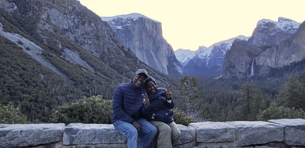
Here, at 7,385 feet above sea level, we could see parts of El Capitan, Half Dome, and Bridalveil Fall. However, the sunrise we had planned for was delayed. The expectation of seeing the valley bathed in light, awakening from its slumber, remained unfulfilled. Nonetheless, the location offered unique photo opportunities that Saf and I revelled in. We politely requested others to take pictures of us with the valley as our backdrop, El Capitan on our left, and the Wawona tunnel exit included.
Disappointed about missing the sunrise and with time being precious, we returned to the car and drove through the tunnel. Located at the end of Wawona Road and measuring 4,233 feet long, it’s the longest highway tunnel in California. If we had continued, this would have led us to Wawona and the Mariposa Grove. Unfortunately, time wasn’t on our side, so we made a U-turn and headed for other attractions within Yosemite.
Now on the Southside Drive, we stopped at the Swinging Bridge picnic area. The restrooms offered much-needed relief, and afterward, we set out to explore the area. The wooden bridge, with the Merced River flowing serenely beneath it, provided a tranquil spot to take in the breathtaking vista. Looking at the river as it flowed joyfully downstream, one couldn’t miss the boulders scattered along the edges. Beyond the small shrubs by the banks, we could also see pebbles beneath the crystal-clear water.
A few meters ahead were the pine trees, which, along with the majestic mountain backdrop, were likely the reason why this area was popular with so many visitors. The air was cold, and there were patches of ice on the wooden bridge, demanding extreme caution as we walked. Looking up at the mountain, we could see scattered flecks of white – snowflakes glittering in the morning sun. Adding to the beauty was the waterfall cascading high up the mountain. A fallen tree, its roots still intact, lay on the ground, as if uprooted. Next to it was a wooden chair for visitors to relax and absorb the undisturbed beauty of nature.
Saf sat on the tree only to realize too late that a sheet of ice had formed on it, leaving her pants wet and cold. This intensified the discomfort she was already feeling. To our right was part of a trail, one of many that crisscrossed the park. Facing north-eastward, the trail was lined with majestic trees on both sides as it disappeared into the distance.
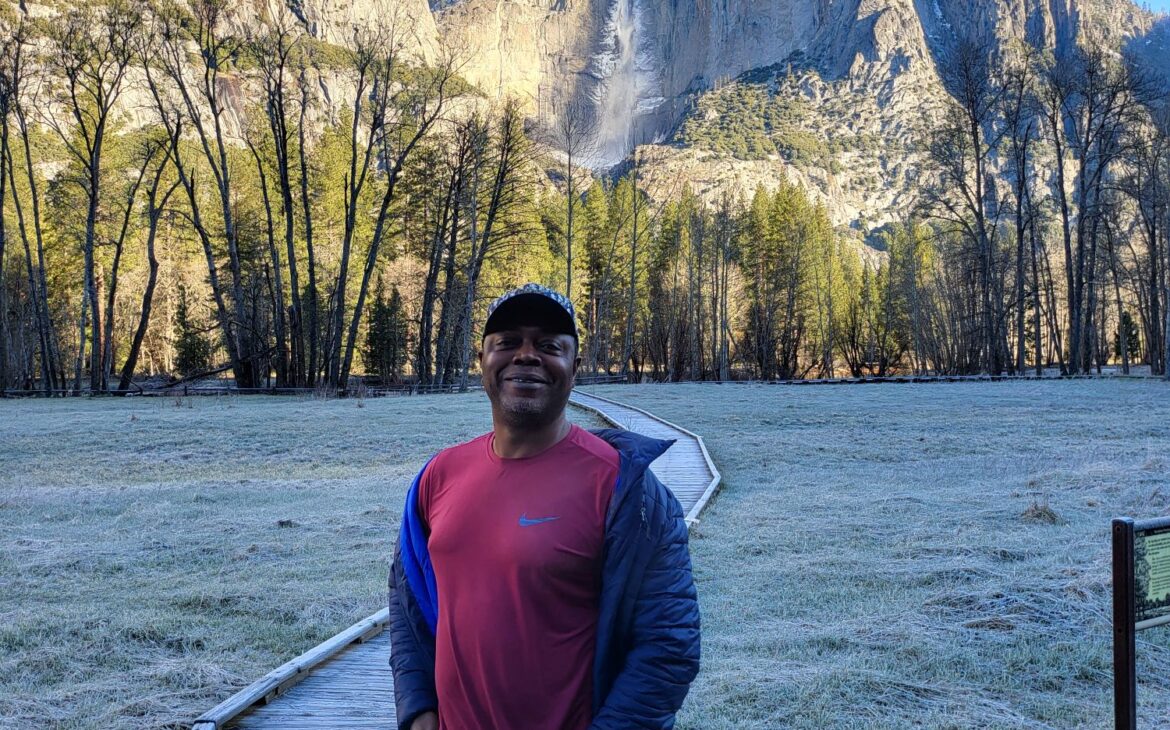
Our drive on Southside Drive kept the Merced River on our left, and we soon arrived at the Hanging Valley viewpoint. Parking a short distance off the road, we joined others taking advantage of the incredible photo opportunity. Nature’s power was on full display as we witnessed the torrential waterfall cascading over the giant rock. While getting closer was an option, we opted out due to the challenging walking conditions. Standing on the wooden walkway leading to the group of trees bordering the mountain and the waterfall presented another fantastic photo opportunity.
Leaving this viewpoint, we made our way to Curry Village, where overnight accommodation was available for visitors who wanted to stay on the campgrounds. Here, we searched for a restaurant to enjoy a decent breakfast before heading to the Visitor Centre.
Exiting the park via the northside drive, we arrived at El Capitan Meadow, where we encountered El Capitan in all its majesty. Standing impregnable, it rose towards the sky, dwarfing everything around it. It was both awe-inspiring and untouchable.
It’s clear that Yosemite is best experienced on foot. For those unable to hike, a trip to Yosemite might not offer its full potential, as many of the most captivating sights are accessible only by foot, not by car.
Exiting the park, we came across the stone structure with the wooden signboard welcoming visitors to the park. Having arrived before dawn, we missed this sight, along with the beauty of sitting by the riverside with its massive boulders. One look at the Merced River, however, and there’s no doubt that it was carved by the massive glaciers that sculpted this valley during the ice age.
Come explore Yosemite National Park and experience its magic for yourself!


